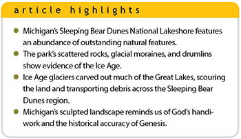
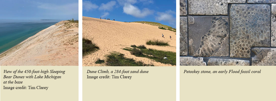
 Like a white winding ribbon along the shoreline, Sleeping Bear Dunes National Lakeshore’s sandy bluffs ascend hundreds of feet above the waters of Lake Michigan. This steep dune face defines the northwestern coastline of Michigan’s Lower Peninsula for over 60 miles, making it the longest freshwater dune system in the world.1
Encompassing 50,000 acres, several inland lakes, and two offshore islands,2 the park is famous for its 284-foot Dune Climb. Travelers from across the world have marveled at these dunes since the park’s induction into the National Park System in 1970.
Once voted the “Most Beautiful Place in America” by Good Morning America’s viewers,2 the park’s terrain was sculpted by a combination of glacial ice, water currents, wind, and a rising land surface. These processes began during the post-Flood Ice Age and continue today, leaving their respective fingerprints on Sleeping Bear Dunes National Lakeshore. But how do we know there was an Ice Age? A visit to the park and the surrounding area provides several observations that are best explained by thick ice sheets.
Ice Age Evidence Abounds
The Ice Age began soon after the Flood and likely lasted for about 500 to 700 years.3 Evidence indicates this was the only Ice Age in Earth’s history.3 Scars in bedrock and piles of unsorted rock, sand, and clay all show that massive ice sheets once extended across the Great Lakes region. Even Michigan’s state rock, the Petoskey stone, can be found in the glacial sediments within the park. Petoskey stones are fossil corals that were plucked by glaciers from the Flood layers just to the north and transported south by the moving ice sheets.
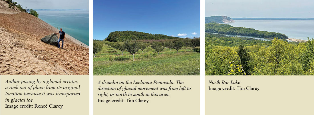
Other observations include out-of-place rocks, like igneous and metamorphic rocks, that were carried by ice from distant locations. These rocks are known as glacial erratics, left behind by the ice sheets as they melted. Petoskey stones are glacial erratics, too.
Another clue that glaciers once covered this landscape is the presence of long, linear hills of unsorted material known as moraines. Moraines form when glaciers melt as fast as they advance, sometimes depositing ridges of debris several hundred feet high. During the Ice Age, the ice sheets left behind a thick blanket of loose sediment called drift across much of Michigan’s Lower Peninsula, including Sleeping Bear Dunes National Lakeshore. Drift is the general name for much of the clay, sand, and rocks transported within the ice.
Drumlins are other glacial landforms we can observe near Sleeping Bear Dunes. These half-mile-long hills of glacial drift are elongated in the direction of glacial flow and are often found in swarms. Exactly how they form is still unclear, but some of them are located just east of the park. They tell us the ice moved from north to south in this area.
Sleeping Bear Dunes is situated near the base of the Leelanau Peninsula, a triangular piece of land that juts about 25 miles north from the park, essentially forming the little finger of Michigan’s “mitten.” The ice in this region flowed due south, scouring out deep troughs in the fresh Flood sediment and leaving a jagged coastline with many peninsulas. Post-Ice Age wind and water currents transported sand across several of these bays, smoothing the shoreline and sealing off smaller lakes from Lake Michigan, such as Glen Lake and North Bar Lake.
 In the northern Great Lakes, the land rebounded hundreds of feet after the Ice Age as the weight of the ice sheet was relieved, causing the ground to rise. Many places in northern Michigan show wave-carved terraces at 50 feet or higher above modern lake levels, attesting to this uplift.4
Similar lake terraces have also been described on Mackinac Island, Michigan, located 85 miles to the northeast.5 About 175 feet of rebound is noted for the Sleeping Bear area, with much more rebound farther to the north.4 These observations and others indicate a thick continental glacier covered the Sleeping Bear Dunes region about 4,000 years ago.3
Two Types of Dunes
Sleeping Bear Dunes has both beach dunes and perched dunes.6 Beach dunes form just past the shore from windblown sand. These are common on beaches around the world. But Sleeping Bear Dunes is unique because it also has perched dunes. These are located on a glacial moraine that intersects the coastline of the park. They form as wind winnows sand from the bottom of the moraine and deposits it on top. Some of the park’s moraines rise 450 feet above Lake Michigan, significantly elevating these dunes. Glacial rebound also contributed to their present height.
Connection to the Global Flood
What caused the Ice Age? Conventional scientists claim it was generated by coinciding shifts in Earth’s tilt, orbit, and wobble over millions of years. However, the dozens of theorized combinations of these minor factors have all failed to account for the major ice sheets.7
Creation scientists have developed a better model that demonstrates how the Ice Age was triggered by the effects of the global Flood.
The acronym HEAT helps us remember this model.7
1) Hot oceans. Rapid tectonic plate movement during the Flood created a hot new seafloor, heating the oceans.
2) Evaporation. Warmer oceans prompted more precipitation to fall on Earth, building up ice sheets.
3) Aerosols. The runaway subduction of old ocean crust also triggered extensive volcanic activity that spewed ash called aerosols. These blocked sunlight, cooling the earth and causing surface temperatures to drop.
4) Time. The cooling of the ocean took time, and continuous eruptions supplied aerosols that kept ice from melting even in the summers.
These ice sheets carved out much of the topography of the Great Lakes and scoured the land, transporting debris across the Sleeping Bear Dunes region and depositing moraines, drumlins, and erratics.
God's Handiwork
God had a plan all along. As the Flood ended, an Ice Age began. Ice buildup lowered the sea level at just the right time to expose land bridges. As a result, animals and humans were able to migrate from the Ark to distant continents soon after the Flood. Once the oceans cooled sufficiently and the volcanic activity began to wane, the ice sheets melted and rising ocean waters covered the land bridges.
Today, Sleeping Bear Dunes National Lakeshore’s beautiful freshwater lakes and sandy beaches are enjoyed by tourists from around the globe. However, it’s also a striking reminder of the historical accuracy of Genesis. Evidence abounds for a global flood.3 The post-Flood Ice Age sculpted and formed Michigan’s landscape, reminding us of God’s handiwork.
References
- Sleeping Bear Dunes National Lakeshore Michigan. National Park Service. Posted on nps.gov.
- Sleeping Bear Dunes Voted “Most Beautiful Place in America.” ABC News. Posted on abcnews.go.com August 16, 2011, accessed September 1, 2023.
- Clarey, T. 2020. Carved in Stone: Geological Evidence of the Worldwide Flood. Dallas, TX: Institute for Creation Research.
- Lewis, C. F. M., S. M. Blasco, and P. L. Gareau. 2005. Glacial Isostatic Adjustment of the Laurentian Great Lakes Basin: Using the Empirical Record of Strandline Deformation for Reconstruction of Early Holocene Paleo-Lakes and Discovery of a Hydrologically Closed Phase. Géographie physique et Quaternaire. 59 (2-3): 187–210.
- Clarey, T. 2022. Mackinac Island State Park: Flood, Ice Age, and...Digestion? Acts & Facts. 51 (7): 10-13.
- Brandes, P. 2023. Michigan Rocks! A Guide to Geologic Sites in the Great Lakes State. Missoula, MT: Mountain Press Publishing Company.
- Hebert, J. 2021. The Ice Age and Climate Change: A Creation Perspective. Dallas, TX: Institute for Creation Research.
* Dr. Clarey is Director of Research at the Institute for Creation Research and earned his Ph.D. in geology from Western Michigan University.